SHARE WITH FRIENDS:
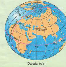
Determining the distance using a level grid
1. Determine the distance along the shortest air route between Australia and Antarctica using the degree grid on the map and globe.
📍 Solution method
The shortest distance between Australia and Antarctica is 1430 east
passes through. Along this meridian, the southernmost point of Australia passes from 380 degrees north latitude to the northernmost point of Antarctica at 67 degrees north latitude.
67° – 38° = 29°
Given that the 1° meridian is 111 km:
111×29 = 3219 km
answer: 3219 km.
2. Calculate the distance between the continents of Australia and South America at 25° N using a grid of degrees. determine in terms of km.
📍 Solution method
From the 180° datum of the eastern tip of Australia
we determine the distance in degrees.
180°-153°=27°
We determine the distance of the western edge of South America from the 180° datum line.
180° – 70°=110°
We add the two results we found:
110°+27°=137°
Based on the table, 25° at 1° N is equal to 100,9 km.
1370 x 100,9=13823,3 km.
Answer: 13823,3 km
3. 20° east of the African continent. how many from north to south
Find out if it is a kilometer long.
📍Solution method:
32°+35°=67°
111 km x 67° = 7437 km
Answer: 7437 km