SHARE WITH FRIENDS:
🔰Scale information
📌Use it several times to describe the places on the earth on paper
will need to be reduced. This is the zoom level
it is said.
📌Mashtab-German mass means length and stab means iron plate. There are basically three types of scale, and the following types of scale are distinguished in topography and cartography:
📌Numerical scale is given in the form of a fractional number, one per decimal
and the denominator is a number showing how many times the image has been reduced
is given. For example 1:1000; 1:10000; 1:1000000 and so on.
📌 What is the length of the line on the named scale-map on the surface of the earth
is expressed in words. For example: 1 m in 100 cm; 1 m in 1000 cm; in 1 cm
10000 m and so on.
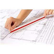
📌Linear scale - it consists of two straight lines with equal cross-sections divided into centimeters. In order to accurately measure distances on the map, the first part of the linear scale is divided into small parts. To the right of the number "0".
the value of large parts is written depending on the side.
Linear scale is large
the cross sections are said to be scale bases.